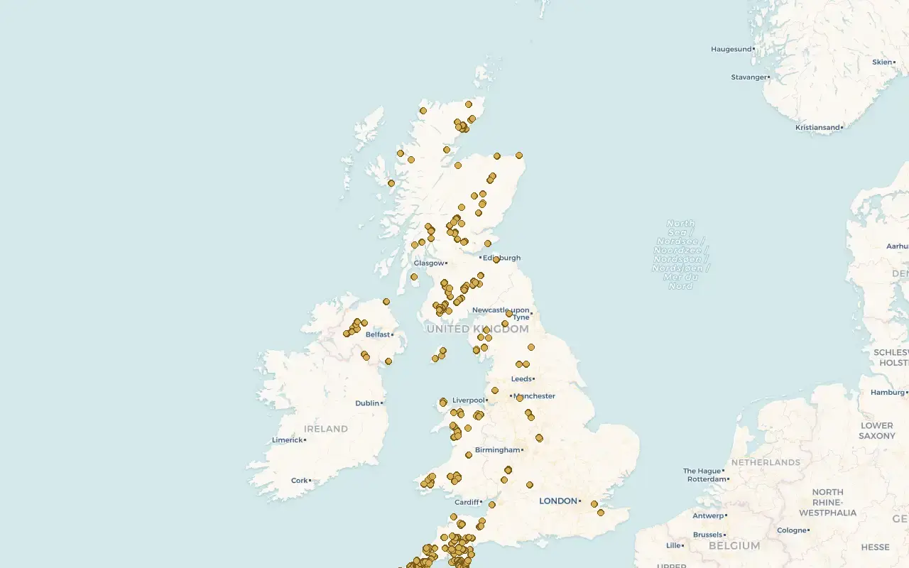
510 gold panning and prospecting sites across England, Scotland, Wales, Northern Ireland and the Isle of Man, 245 of them verified — with GPS, access notes, and the law explained in plain English.
★★★★★5/5 from 4 member reviews
Start exploring with a free account — 200 verified sites £29.99, once, yours for life.
Every pin is a real location with the detail you actually need before you drive there.
No. 1
500+ sites with access notes
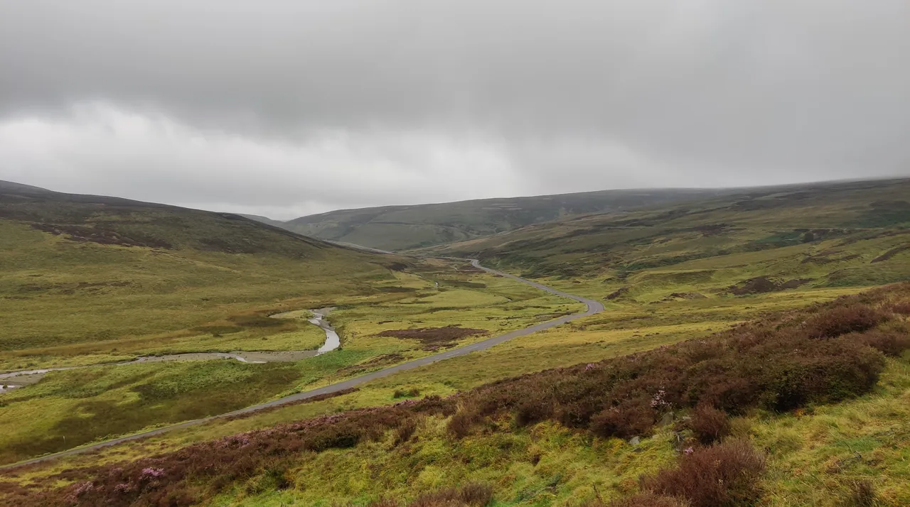
From the Mennock Pass to the Afon Mawddach — each site carries what's been found there, how to reach it, and what to expect when you arrive. Because the most expensive part of this hobby isn't the kit — it's the petrol you burn driving to a river that never held gold.
No. 2
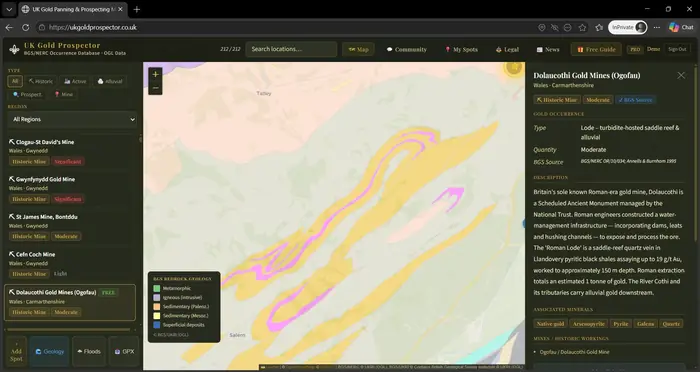
Geology that shows you why
Toggle the bedrock overlay and see the gold-bearing formations under your feet — so you can read a valley the way experienced prospectors do, and find spots that aren't on anyone's list.
No. 3
Stay on the right side of the law
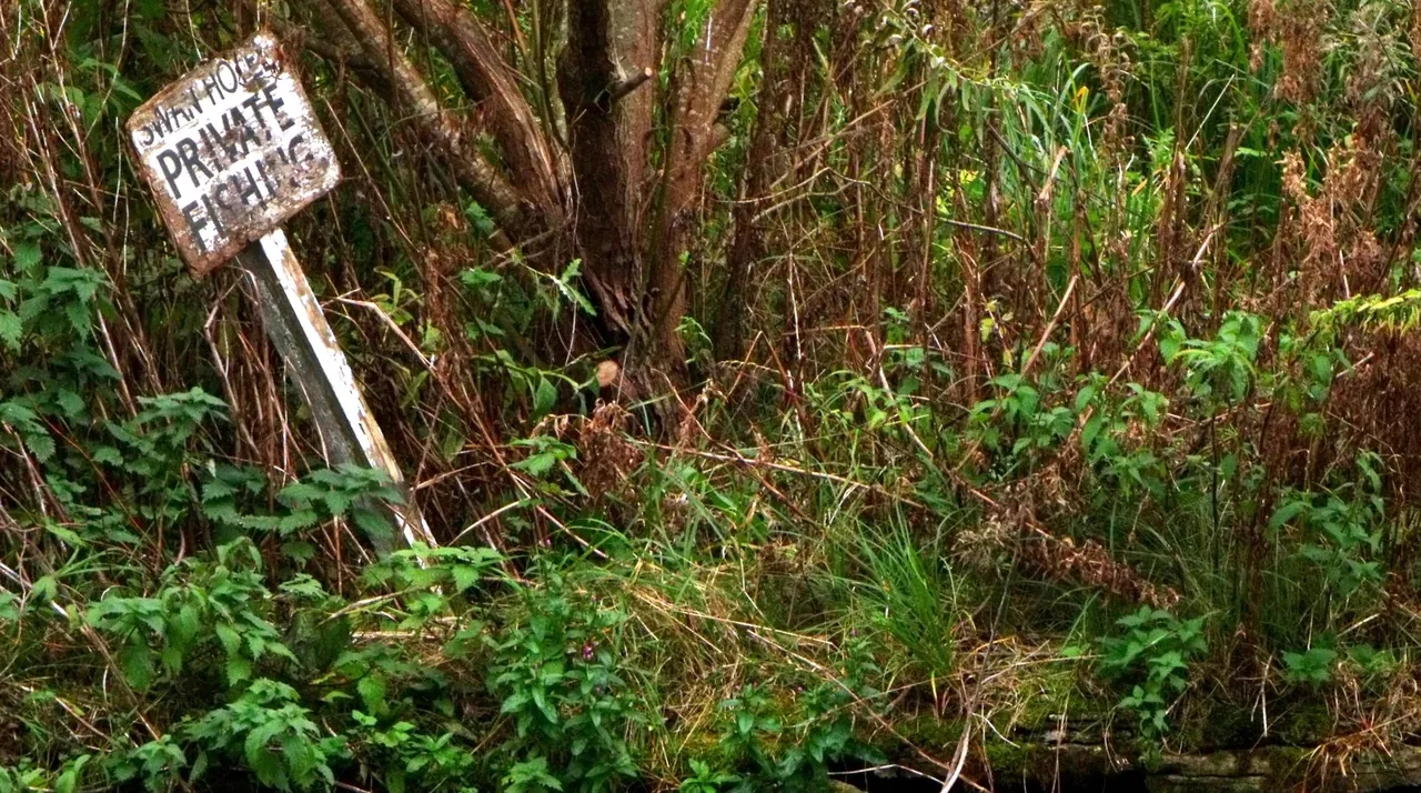
UK gold has rules — landowner permission, Crown rights, and permits in some areas. The map flags what applies where, in plain English, so you pan with confidence.
Member reviews
Rated 5/5 by the people using it
Excellent website for both newbie, occasional hobbyists like me... and experienced gold prospectors in the UK. Interactive maps, packed with useful information which have helped me discover new locations I wouldn't have found otherwise. All of the information you could possibly need, in one place.
★★★★★ Sadie L
"Great app, easy to use and has helped me find new spots. Anyone looking to get into panning should start with this."
★★★★★ Darnold92
"Easy to use friendly site and great navigation tool. A simply must have site — very happy."
★★★★★ Lee Cutts
Pay once for the map. Pro is optional.
£29.99 once. Yours for life.
Less than a tank of petrol to a duff spot — and you only pay it once. Start exploring free, then one lifetime payment unlocks 200 verified sites with GPS and access notes. No subscription needed for the map, ever.
Want more? Add Pro to the map and you get every site — 510 sites in total, including 296 Pro-only sites the lifetime map does not cover — plus the BGS geology overlay and 10 new sites a month from November 2026, for £9.99 a month. Cancel anytime and the map stays yours.
Straight with you — this is a guide, not a guarantee. Every pin is a real, recorded gold site, but whether you find colour still comes down to the exact spot, how deep you dig and how well you pan.
These colours are for the zoomed-out UK map (BGS 1:625,000). When you zoom in, the detailed 1:50,000 map uses BGS's own colour for each rock unit - tap the map to identify any of them. Colours on the map are see-through, so they look paler than this key.
Lines on the detailed map
Mineral vein (seen)
Mineral vein (inferred)
Fault (seen)
Fault (inferred)
Thrust fault
Shear zone
Dyke
Edge of hydrothermally altered rock
Edge of baked zone round an intrusion
Coal seam
Rock colours on the UK overview
🌊 River Flood Risk
Flood Alert
Flood Warning
Severe Warning
No Current Alert
England: Environment Agency Live data — updated hourly
⚖️ UK Gold Prospecting Law
Know your rights — and your obligations — before you go out
⭐ Enjoying UK Gold Prospector?
A quick rating on Google Play genuinely helps other prospectors find the map. It takes ten seconds.
⚠️ Gold and silver in the ground belong to the Crown (by royal prerogative in England and Wales, and the Royal Mines Act 1424 in Scotland). There is no general legal right to take alluvial gold — only informal tolerance in specific circumstances. See the full guide below before you prospect.
No Guarantees - What This Map Is (and Isn't)
UK Gold Prospector maps places where gold has been recorded - BGS survey data, historic mines and documented finds. A pin is a researched starting point, not a promise of gold. Some records reflect trace amounts, or workings long since exhausted.
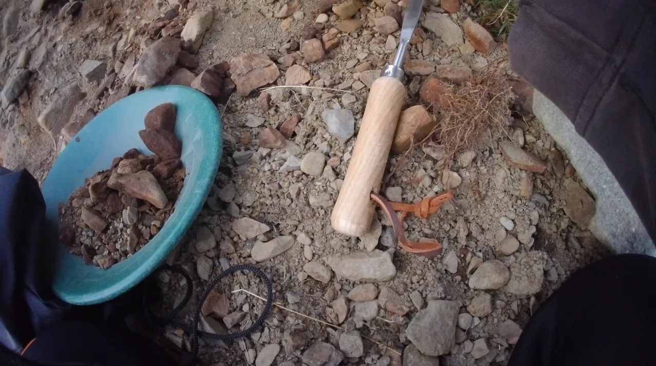
Finding colour still comes down to you: picking the right spot within an area, reading the river and working the right gravel - inside bends, bedrock traps, behind boulders - panning correctly, and putting the hours in. Most pans are empty. That is normal prospecting, and no map changes it.
Where These Locations Come From
Most locations on this map are compiled from public sources: British Geological Survey (BGS) open data and Mineral Reconnaissance Programme reports, Ordnance Survey grid references, and public mineral-occurrence records. Gold occurrences in the UK are documented facts in the public record - we cross-check sites against these sources where a record exists, and all geology is attributed to BGS.
Place names and OS grid references are facts, free for anyone to use. The research, verification and presentation here are our own - this map does not reproduce any commercial gold-location guide or copyrighted compilation.
For the complete legal picture — Crown rights, Scotland permits, Wales enforcement, wildlife law, and the Treasure Act — read the full guide:
Crown owns all alluvial gold. Crown Estate tolerates casual recreational panning — not a legal right. Landowner permission required for access. No public right to roam rivers.
🏴 Wales
Same Crown rights as England. NRW actively enforces SSSI and SAC restrictions. A panner was convicted in 2022 for unlicensed panning in a protected river, and a repeat offender again in September 2026. Landowner permission essential.
🏴 Scotland
Land Reform Act 2003 gives river access rights. Crown Estate Scotland (July 2023) states no permission is granted to remove gold. Kildonan, Tyndrum and Wanlockhead permit sites remain the safe option.
🇬🇧 Northern Ireland
No right to roam — landowner permission required. Crown rights to gold and silver (Mines Royal) apply. Under the Historic Monuments and Archaeological Objects (NI) Order 1995, any search involving digging requires a Historic Environment Division (HED) licence — surface panning without digging is a grey area. Sperrin Mountains has active commercial mineral licence areas; check before prospecting.
What NOT to Do
⛔ Do not pan in any SSSI, SAC, or Scheduled Ancient Monument — criminal offence, unlimited fine
⛔ Do not dig into river banks — may constitute reckless disturbance of protected species (otter, water vole) under the WCA 1981
⛔ Do not pan Oct 1 – May 31 in known salmon spawning rivers — BGA Code of Conduct; some rivers legally protected
⛔ Do not use powered or motorised equipment without a Crown Estate extraction licence
✅ Always get landowner permission before accessing private land or rivers
✅ Fill in all holes the same day. Leave the site exactly as you found it.
✅ Pan and sieve only — hand tools permitted; no petrol pumps, dredges or suction equipment
The Treasure Act — What Prospectors Need to Know
Raw alluvial gold — flakes, nuggets, dust — is not reportable under the Treasure Act 1996. It is not an "object" under the Act.
If you find a worked object (coin, ring, torc, artefact) that may be 300+ years old:
Contact your Finds Liaison Officer (FLO) via finds.org.uk — this is the recommended first step
You have 14 days from believing an object is Treasure to report it
The coroner is involved later in the formal inquest process
Finders may receive a reward based on market value
All location descriptions have been independently rewritten from primary source materials. No text is reproduced verbatim from any copyrighted publication.
Pick how much of the map you want. The map is a one-off payment, yours for life.
👁
Right now
4
locations
⭐
Free account
8
locations
⚜
Lifetime
200
verified sites
Your area
£19.99
One region's sites England (+NI & IoM), Scotland or Wales
+ FREE PRO MONTH
Full map + Pro trial
£29.99
200 verified sites (214 in total) for life + Pro free for 30 days then £9.99/mo unless you cancel
ONE PAYMENT
Full map only
£29.99
200 verified sites (214 in total) for life One payment never billed again
Same £29.99 for the map either way. The only difference: Full map + Pro trial adds a free 30-day Pro trial (BGS geology + 296 Pro-only sites), which renews at £9.99/mo unless you cancel. Cancel anytime and you keep the map.
Already have an account?
🔒 Stripe · Apple Pay · Google Pay💷 30-day refund, no questions👥 190 prospectors on board
A guide, not a guarantee - every pin is a real recorded gold site, but finding colour is down to you.
Not ready yet? Grab the free Beginner's Pack →
⚜ Go Pro — BGS Geology + new sites
BGS geology overlay + 296 Pro-only sites now (510 sites in total), and 10 new sites a month from November 2026
BGS bedrock geology overlay
296 Pro-only gold sites already on the map
10 new sites a month from November 2026
Monthly
£9.99/month
Cancel anytime · instant access
SAVE £40.88
Yearly
£79/year
Works out £6.58/mo · a full year, paid once
🔒 Secure payment via Stripe · Instant access · 30-day, no-questions refund on either plan
 Mineral vein
 Fault
Fault Dyke
Dyke Mineral vein (inferred)
 Shear zone
 Edge of hydrothermally altered rock
 Edge of baked zone round an intrusion
 Coal seam