Short answer
Scotland is the best place to pan for gold in the UK, and the only one with permit-backed sites open to the public. Three locations let beginners pan legally under a permit: the Strath of Kildonan in Sutherland, Wanlockhead in the Lowther Hills, and Tyndrum (Strathfillan) in the Highlands. Statutory access rights under the Land Reform (Scotland) Act 2003 let you reach most rivers, though the Crown still owns the gold itself — the permit sites are the cleanest legal route.
Scotland is the only part of the United Kingdom where a complete beginner can turn up at a riverside village, buy a permit over the counter and pan real gold in a Highland burn before the afternoon's out. It is not a romantic claim. It is a geological accident — the kind of accident that left the Strath of Kildonan, the Lowther Hills and the Cononish vein up at Tyndrum sitting on top of Britain's only commercially viable gold deposits, and that left the modern hobbyist three permit-backed sites where the law, the landowner and the river all line up.
This is the long guide to all of it. It covers the geology that produced Scottish gold in the first place, the three permit-backed sites where the public can legally pan, the quieter goldfields at Glen Shira and the Ochil Hills where the legal route is much harder, the law as it actually stands in 2026, the season and equipment rules at each site, the 1868–69 Sutherland Gold Rush and the modern record nuggets, and a straight reality check on what you will and will not find. It is written for the hobbyist working a pan and a trowel — not for the commercial sector — and every named location in it is on the UK Gold Prospector interactive map with the access notes you need before you go.
In this guide
- Why Scotland is the UK's gold-panning capital
- The geology behind Scottish gold
- The Strath of Kildonan — Sutherland's flagship goldfield
- Wanlockhead, Leadhills and the Lowther Hills
- Tyndrum and Strathfillan — the Cononish country
- Glen Shira, Argyll and the Ochil Hills — quieter goldfields
- Scottish gold-panning law in plain English
- Best season, water conditions and equipment
- The 1868–69 Sutherland Gold Rush and Scotland's famous nuggets
- Frequently asked questions
See the verified Scottish gold sites on the live map
200 verified UK locations with GPS coords, access notes and geology — Kildonan, Wanlockhead, Tyndrum and the rest, mapped in seconds.
Unlock the Scotland gold map — £19.99, one-off
Every verified Scottish gold site on the live GPS map: exact coordinates, permit notes and access. Pay once with card, Apple Pay or Google Pay, then claim it with your email — no subscription.
Why Scotland Is the UK's Gold-Panning Capital
Three things sit underneath the answer, and none of them are nostalgia. First is the bedrock. The Scottish Highlands and Southern Uplands contain real gold-bearing source rocks — primary mineralisation, in the geologists' sense — laid down over hundreds of millions of years of tectonic activity. England has occasional gold. Wales has a famously beautiful but legally constrained gold belt around Dolgellau. Scotland has three distinct gold provinces, each one productive enough to have sustained mining or rushes in living memory or recent history.
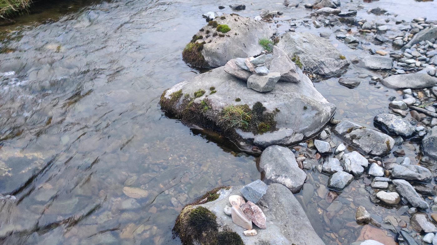
Second is glaciation. The last ice age finished tearing across Scotland only about 11,500 years ago. As the ice sheet retreated it ground down the bedrock, liberated gold from veins and pyritic source layers, and left the meltwater of every Highland and Uplands valley to sort that gold into the modern stream gravels you now pan. The geology made the gold; the ice did the heavy lifting of getting it into the rivers; the rivers are still grading and concentrating it every winter. Almost everything you can recover with a pan in Scotland today is alluvial — that is, river-borne — and almost all of it owes its accessibility to the Pleistocene. Fifty-five Scottish burns and rivers that carry it are named in the Scotland section of our list of gold-bearing rivers in the UK.
Third is the law, or rather the lack of obstruction. Scotland has a statutory right of responsible access under the Land Reform (Scotland) Act 2003 that gets you onto the land in the first place, and it has established permit schemes at Kildonan, Wanlockhead, Tyndrum and Leadhills where the relevant landowner or community trust sells permits to recreational panners. England has no such framework. Wales has actively prosecuted unlicensed panning. Northern Ireland has no recreational permit scheme; gold and silver rights rest with the Crown Estate Commissioners (DfE). Scotland is the only nation in the UK where a hobbyist can plan a weekend without first having to chase a private landowner for written permission.
The combination is unique. Most countries with productive placer gold are either far away (Alaska, British Columbia, Western Australia) or legally complicated. Scotland gives you an overnight train, a £15 day permit and a burn that has been producing flakes since the Romans worked it. If you are entirely new to the hobby, our beginner's guide is the starting point. If you want the regional comparison, our guide to gold panning in Wales covers the next-best-thing south of the border.
This guide is the deep version of "where". It moves region by region across Scotland, explains why the gold is where it is, sets out the rules at each site, and finishes with a sober account of the law, the season and the realistic expectation for an afternoon on the water.
The Geology Behind Scottish Gold
Scottish gold is not evenly distributed. It sits in three geological provinces that, although separated by hundreds of kilometres and a quarter of a billion years of history, share a common story: a fluid pushed through a rock at depth, deposited gold along the way, and was later weathered, eroded and rinsed into stream gravels. Understanding the broad picture saves you panning the wrong burn for the right reasons. The three provinces below hold most of Scotland's panning ground; for the full picture, including Rhynie's ancient hot-spring gold and the history of Scotland's gold mines, see our guide to is there gold in Scotland.
The Dalradian Highlands — the central spine
The diagonal sweep of country running from Argyll through Perthshire and into the Cairngorms is built largely on the Dalradian Supergroup — a thick pile of metasedimentary rocks (schists, quartzites, pelites, calcareous beds and a few volcanic horizons) laid down between roughly 730 and 480 million years ago, then deformed and metamorphosed during the Caledonian Orogeny when the ancestral land masses of Laurentia and Avalonia collided. That collision did two useful things for gold prospectors. It pushed warm, mineral-rich fluids through fracture systems in the Dalradian rocks, depositing quartz veins as it went. And some of those quartz veins carry gold — most famously the composite Eas Anie vein at Cononish near Tyndrum, the host rock of Scotland's only modern commercial gold mine.
You don't need to be working that single vein to benefit from the Dalradian story. The geology continues for hundreds of kilometres along the Caledonian grain, and every burn that drains a structurally favourable section of it has been releasing flakes into its gravels for the eleven and a half thousand years since the ice withdrew. Glen Shira, Glen Orchy, the wider Strathfillan country, parts of the central Ochils — they are all Dalradian or Dalradian-influenced, and they all carry alluvial gold to varying degrees.
The Southern Uplands — Wanlockhead and the Lowther Hills
South of the central belt the geology changes. The Southern Uplands are built largely from the Hawick Group and related Silurian sandstones, accreted as the Iapetus Ocean closed during the early stages of the same Caledonian event. The Wanlockhead and Leadhills area sits over a stratabound zone of pyrite and arsenopyrite mineralisation in those rocks, and arsenopyrite in particular is the local carrier of gold — the gold sits inside the arsenopyrite at the trace level, but there is enough of it, distributed over a wide enough area, that several centuries of weathering have stripped it out of the source rock and deposited it into the burns of the Lowther Hills.
This is a fundamentally different deposit type from Tyndrum. The Dalradian gold is mostly in discrete quartz veins. The Lowther Hills gold is dispersed through wide pyritic horizons. The practical consequence for the panner is the same — flakes and the rare picker in stream gravel — but it is the reason the Wanlockhead burns have been productive for so long and across so many separate tributaries.
Sutherland — Moine schists, altered granite and the Helmsdale system
The Strath of Kildonan and the wider Helmsdale catchment in eastern Sutherland sits over yet another geology again. The country rock here is Moine — older than Dalradian, metasedimentary in the same broad family but laid down further back. Through that Moine basement, narrow granite intrusions of the Strath Halladale Granite were emplaced in the late Caledonian, and it is in deeply weathered zones of those granites that most modern work attributes the gold source. Pebbles of altered granite recovered from Suisgill Burn carry visible auriferous mineralisation, and the chemistry of the placer gold itself — slightly more silver-rich in the Suisgill watershed than in the adjacent Kildonan and Kinbrace burns — supports a localised, structurally controlled source.
The reason this matters is that the Sutherland source is more concentrated and more nuggetty than the broader Wanlockhead dispersal. Sutherland produced the 1869 rush, and it remains the most likely place in Britain to recover a piece of gold large enough to call a picker rather than a flake.

Why all UK panning gold is alluvial
Across all three provinces the story ends in the same place. The bedrock source — vein, lode or dispersed sulphide — was buried at depth and inaccessible until the ice age. The Pleistocene glaciation between roughly 115,000 and 11,500 years ago scoured the surface, exposed the source rocks, and concentrated their eroded fragments into glacial outwash gravels and post-glacial stream deposits. The streams have been re-sorting those gravels ever since, dropping gold out in inside bends, behind boulders, into bedrock cracks and along gravel-bar tails. Recreational hard-rock mining of vein gold is functionally impossible in the UK for legal and practical reasons. Recreational alluvial panning works because the river has done all the milling and concentration for free.
The Strath of Kildonan — Sutherland's Flagship Goldfield
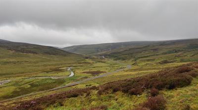
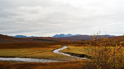
If Scotland has a spiritual home of gold prospecting it is the Strath of Kildonan, a long, sparsely populated glen running north-west from the village of Helmsdale on the Sutherland coast. The two named gold-producing tributaries of the Helmsdale River — Kildonan Burn and Suisgill Burn — meet the main river within a few miles of each other, and the whole system has been producing gold continuously since Robert Nelson Gilchrist's systematic prospecting trip of 1868. The 1869 rush gave the country its place in the popular imagination; the modern permit scheme run by the Suisgill Estate gives the modern hobbyist a practical way back in.
The Suisgill Estate permit
The Suisgill Estate sells day permits for the Kildonan Burn (the Suisgill Burn needs the estate's prior written consent). As of 2025–26 the structure is simple: roughly £15 per adult per day, free for under-16s accompanied by an adult with a valid permit, around £10 for 16–18 year-olds, and on proof of a stay in a Helmsdale B&B or hotel the permit holder may bring a companion panner. Permits are now issued online via QR code rather than over the counter. There are limits — a maximum of two weeks per person per calendar year, taken in no more than two separate periods — and the season runs from 15 April to 1 October, with no panning permitted outside that window. Hours are 8am to dusk or 10pm, whichever comes first.
The permit dictates what you can carry into the water. A pan, a riddle or hand sieve, a trowel, a small spade and a hand-operated gravel pump with a barrel of up to 2.5 inches are allowed. Sluices are explicitly prohibited. The permitted stretch of the Kildonan Burn runs upstream from the stone bridge at Baile an Or to the Kildonan Falls — the same stretch the 1869 prospectors worked. The Suisgill rules are tighter than some other Scottish permit schemes, and they exist to balance recreational prospecting with the estate's sporting interest in the salmon fishery. Our guide to who issues each Scottish panning permit and how to buy one compares the Suisgill fee with the other three schemes.
Reading the river
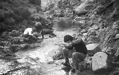
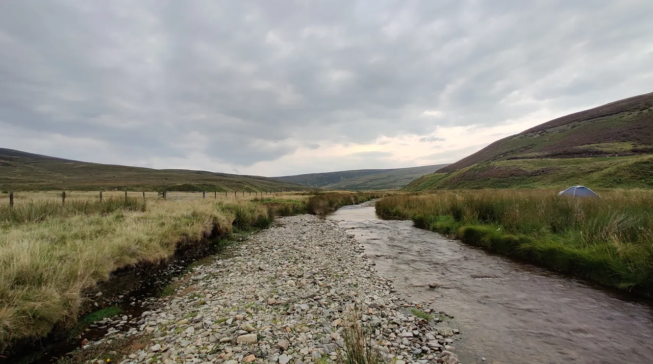
The Kildonan and Suisgill Burns are classic upland Highland streams. Boulder and cobble beds in the active channel, exposed schist or granite bedrock at intervals, occasional pools and short riffles where the gradient steepens, and gravel bars at the inside of every meaningful meander. At low summer water — typically from mid-June onwards in an average year — the bedrock cracks, the pressure shadows behind larger boulders and the gravel-bar tails are all easy to walk in waders or wellies. The water is shallow, clear and cold.
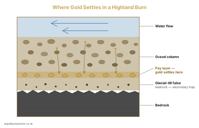
Where to dig comes down to the standard placer logic: gold sinks until it stops, and it stops where the current slows. The inside of a bend, the slack water behind a stationary boulder, a crack in the underlying bedrock perpendicular to flow, and the trailing end of a gravel bar are the headline trap families, and any productive day at Kildonan will work two or three of them. Full technique is in our river-reading guide; the burn-specific point is that the gradient and the cobble size do most of the sorting for you. You do not need to walk far from the parking area to find legitimate productive water.

What you'll actually find
Both burns produce flake gold reliably and occasionally yield pickers — pieces large enough to lift between finger and thumb. The Suisgill catchment historically carries a slightly higher proportion of larger flakes and is more silver-rich in alloy composition, both of which point at the localised altered-granite source. The Kildonan Burn is the iconic rush stream and tends to be busier with day-permit panners working the well-known stretches. Neither burn produces nuggets except as multi-decade exceptional events.
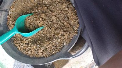
A fair day in late June or July, working two or three productive features methodically, is comfortably a dozen flakes in a snuffer bottle and the satisfaction of having recovered Sutherland gold under the same legal framework that the original rush prospectors operated under. The remoteness of the glen, the train halt at Kildonan station, the deer on the hillside and the curlews overhead are part of what makes this site the one Scottish goldfield every prospector should work at least once.
Wanlockhead, Leadhills and the Lowther Hills
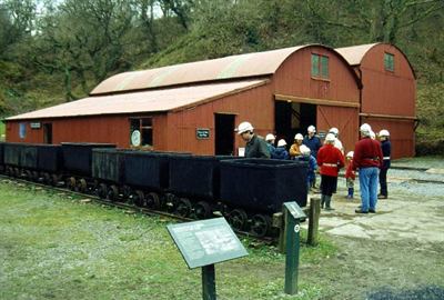
If Kildonan is the iconic site, Wanlockhead is the practical one — the place a beginner with no kit, no contacts and no experience can be panning real Scottish gold within an hour of arriving. The village sits at around 470 metres in the Lowther Hills of South Lanarkshire and Dumfries & Galloway, billed as the highest village in Scotland and known historically as "God's Treasure House" for the lead, silver, zinc and gold it has produced from at least the 16th century. The Museum of Lead Mining at Wanlockhead is the modern hub for recreational panning across the whole district.
The Museum of Lead Mining licence
The Museum sells gold panning licences on behalf of Buccleuch Estate, which owns the rights to most of the productive water around Wanlockhead and Leadhills. Licences are offered as day, week or annual options, and the Museum also runs taught day-courses for absolute beginners where pans, classifiers and tuition are bundled with the licence fee. The combination is unique in the UK. You can walk into the Museum on a Saturday morning, hire the kit, learn the technique, get the legal cover and be in the Mennock Water by lunchtime.
The licensed stretches cover the Mennock Water and Wanlock Water and several of their feeder burns, including the Glengonnar Burn on the Leadhills side. The Museum staff and the locally based panners can usually point you at whichever stretch is currently producing or which is sheltered from the prevailing weather. The licence does not include freedom to dig the bank — that remains illegal everywhere — and there are restrictions on sluice use that you should read at the point of purchase.
Reading the Mennock and Wanlock Waters
These are textbook upland burns. Shallow, fast, cobble-floored channels with bedrock exposures every fifty metres or so, frequent boulder steps, and the entire stream effectively a long continuous riffle stepping down the hill toward the Nith. There is very little classic meander development — the gradient is too steep and the valley too narrow — so the dominant trap families are bedrock crevices, pressure shadows behind larger boulders, and the gravel bar tails on the broader stretches near the village.
The Mennock Pass road runs alongside the Mennock Water for several miles between the A76 and Wanlockhead village, giving an unusually accessible series of riverside parking spots. Glengonnar Burn and the Wanlock Water enter the system from the Leadhills side; both are productive and both are smaller and more intimate than the Mennock itself. Beginners are best served by working two or three test pans across the easy-access stretches first to get an eye for what colour looks like in a Lowther Hills pan, then committing time to the most productive single feature. The technique points are covered in our river-reading guide and apply directly here.
Historic context and realistic expectation
The Mennock Water has produced documented nuggets, including an 18-gram piece quoted by Wanlockhead-area sources at a value of around £10,000 in current market terms. Those are exceptional. The typical productive day at Wanlockhead is the same as at Kildonan — a dozen flakes, mostly half-millimetre to two-millimetre flat pieces, plus a snuffer bottle of black sand that should be panned out properly at home rather than chased to clean recovery on the bank. The 1510 documentary reference to Wanlockhead gold panning, often cited as the earliest written mention, almost certainly represents continuity from a much older Roman or pre-Roman tradition; the productivity of the burns has been a known quantity for two thousand years.
If you are buying the budget bundle and turning up cold, this is the site. The taught course removes every common beginner mistake in the first hour. It is also the most weather-resilient of the three permit sites because the village itself offers warm shelter when the Lowthers are doing what they do best in spring and autumn.
Tyndrum and Strathfillan — the Cononish Country
Tyndrum sits at the head of Strathfillan, at the meeting point of the A82 and A85, an hour and a quarter north of Glasgow and within the Loch Lomond and the Trossachs National Park. The geology under your boots there is Dalradian — the same metamorphic sequence that hosts the Cononish vein up the glen — and the burns running off the surrounding hills carry alluvial gold that has been known to the locals for at least four hundred years. The legal route to recreational panning at Tyndrum, however, is more specific than the geology suggests, and the most common confusion in this area is mistaking the famous mine for somewhere you can actually pan.
Cononish is the mine — not the panning spot
The Cononish project, around three kilometres up Cononish Glen from Tyndrum village, is a working commercial gold and silver mine now run by Acrux Gold. It is hosted in a single composite quartz vein — the Eas Anie vein — running close to a sub-vertical fault inside the Dalradian metasediments. It is not, and never has been, a public panning destination. Recreational access to the immediate mine area is restricted, the workings are an active industrial site under planning consent from the Loch Lomond and the Trossachs National Park, and under Scotgold, gold from Cononish went into a chain-of-custody system that ended in hallmarked Scottish-gold jewellery. The mine matters to the article because it proves the geology, not because you can pan it.
Where the public actually pan at Tyndrum is the Tyndrum Community Woodland, a separate area of forestry-and-pasture land managed by the Strathfillan Community Development Trust. The Trust operates a permit scheme for recreational gold panning within the community woodland's drainage. Permits are bought through the Trust's website, the proceeds support local community projects, and the conditions follow the standard SEPA good-practice template — hand tools only, no bank digging, refill any hollows the same day, no panning during the spawning closure. Always confirm current pricing and conditions on the Trust's site before travelling.
Reading the Strathfillan burns
The streams of Strathfillan are typical Dalradian Highland burns — modest to moderate gradient, mixed boulder and cobble beds, exposed schist bedrock at intervals, and the heavy glacial overprint of the last ice age in the form of till banks, outwash gravels and the occasional pocket of glacially-deposited boulder clay acting as false bedrock. The technique is the same as on the Mennock or the Kildonan, but the texture of the country is wetter and more wooded — partly because the western edge of the Highlands catches Atlantic weather, partly because the community woodland is, by definition, a managed forest landscape.
What this means practically: the headline traps are bedrock cracks where the schist is exposed, pressure shadows behind boulders in the steeper sections, and the gravel bar tails on the gentler stretches further down the catchment. Root mats on the bank — fibrous mats of grass and tree roots growing over bedrock or anchored in mid-stream — are a useful secondary trap in the wooded sections of the woodland streams. Full technique is in our river-reading guide.

What to expect
Tyndrum delivers the same realistic outcome as the other two permit sites: a productive day is flake gold and the satisfaction of working it cleanly, with the bonus of knowing the geology under your feet is the same Dalradian sequence the Cononish miners are extracting commercially. The country around the village — the West Highland Way passes through, Ben Lui is in the next glen, the Cononish track is a popular walk — gives Tyndrum a different feel from Kildonan's deep remoteness or Wanlockhead's village-centred convenience. It is the most "Highland tourist" of the three sites and it suits a weekend trip that combines panning with walking.
For the permit details, the Cononish-versus-Community-Woodland distinction and how to read the Strathfillan burns, see our dedicated guide to gold panning at Tyndrum.
Glen Shira, Argyll and the Ochil Hills — Quieter Goldfields
Beyond the three permit-backed sites, Scotland has at least two other regions where alluvial gold is well documented in the geological literature and has been worked recreationally in the past. They are Glen Shira (and the wider Argyll glens, including Glen Orchy) and the central Ochil Hills around Glendevon. They are not, however, beginner alternatives — and treating them as such is the single most common way Scottish prospecting trips go legally wrong. The hard truth is that without a permit framework, the path to legitimate recreational panning at these sites is materially harder and significantly riskier.
Glen Shira and the Argyll glens
Glen Shira drains north-east into Loch Fyne above the village of Inveraray. The country rock is Dalradian, in the same broad sequence as Tyndrum, and the Shira and its feeder burns carry alluvial gold consistent with that source. The adjacent glens — Glen Orchy in particular, which feeds into the upper Awe system — share the geology and the gold-producing reputation. None of these glens, however, has an organised recreational permit framework. The land belongs to private sporting estates and other landowners; the rivers are salmon and trout water; the access is via the Land Reform (Scotland) Act 2003 only.
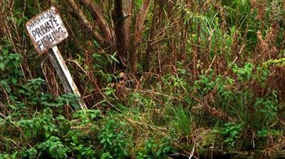
The Act gets you to the river. It does not get you the gold. To pan legitimately you need direct, ideally written, permission from the actual landowner — which means identifying who owns the relevant title, contacting them, explaining your activity, securing their agreement in writing, and then operating within SEPA's full good-practice criteria including the salmon-spawning closure. That is a meaningful piece of legal legwork and most casual visitors are not going to do it. The risk of operating without it is that you become an offence under the Royal Mines Act, the Land Reform Act access exclusions on mineral extraction, and potentially the Controlled Activities Regulations administered by SEPA.
The Ochil Hills and Glendevon
The Ochil Hills, running east–west across central Perthshire and Clackmannanshire, were the subject of a British Geological Survey Mineral Reconnaissance Programme report in the early 1990s that concluded alluvial gold was widespread and locally abundant across the central Ochils, derived from multiple small bedrock sources rather than a single major deposit. Glendevon and the smaller streams off the southern scarp toward Auchterarder, Dunning and Bridge of Earn are the places most commonly referenced. The Ochils never went through a rush, were never the focus of organised commercial mining at scale, and remain a quieter and less worked-over goldfield than Sutherland or Wanlockhead.
They are also less accessible to the recreational panner. There is no community trust, no estate office selling permits, no equivalent of the Museum of Lead Mining. The same Land Reform Act access applies and the same Crown ownership of gold applies; the practical effect is the same as Glen Shira. You need to do the landowner identification, secure permission, and comply with SEPA — and you need to do all of that yourself before you reach the river bank.
Why this matters
If you are reading this guide as an experienced prospector who already understands UK land tenure, who already has a working relationship with local estates, and who is willing to do the legal preparation for an unscheduled site — Glen Shira and the central Ochils are real, productive opportunities away from the busier permit sites. If you are reading this as a first-time panner, please do not. Stick to the three permit-backed sites until you have a season or two of experience under your belt. The full legal framework is set out in our UK gold panning laws guide, and the consequences of getting it wrong — at any of these locations or anywhere else in Scotland — are not theoretical.
Scottish Gold-Panning Law in Plain English
Three layers of law sit over recreational gold panning in Scotland. Permit-site panners deal with all three at once because the host scheme handles two of them on their behalf; everyone outside the permit-site framework has to deal with all three personally. Understanding which layer does what is the difference between a legitimate hobby and an offence.
Layer 1 — the Crown owns the gold
Under the Royal Mines Act 1424, all gold and silver in Scotland — whether in situ in the rock or recovered as alluvial flake — is vested in the Crown. The rights are administered by Crown Estate Scotland (CES). The single most important point to understand, and the one most commonly mis-stated by competitor websites, is that Crown Estate Scotland does not issue recreational gold-panning licences. CES's public position, set out in their 2023 statement on recreational gold panning, is that they do not grant permission for the removal of gold for recreational purposes, and that anyone removing gold without their consent is technically committing an offence under the Royal Mines provisions.
This is the credibility-defining point. The three permit schemes at Kildonan, Wanlockhead and Tyndrum are not delegated Crown licences. They are local working arrangements with the relevant landowner (the Suisgill Estate, Buccleuch Estate, and the Strathfillan Community Development Trust respectively). The landowner controls access, the permit fee covers access, and the long-standing practice at each site is that the local arrangement plus SEPA compliance plus restraint about the volume removed has not historically been challenged by CES enforcement. That is a different legal position from "you have a Crown licence". Read the small print: the Suisgill rules describe the activity as recreational; they do not pretend to be a Crown grant. The same goes for the others.
What this means practically: you should follow the permit, you should follow SEPA, you should not commercialise your finds without taking specific advice, and you should treat your recreational specimens as something the Crown technically owns but is, in practice, not enforcing against where you operate within the recognised framework. The grey area is real and our UK gold panning laws guide covers it in more detail.
Layer 2 — Land Reform (Scotland) Act 2003
The 2003 Act codified into Scots law the statutory right of responsible access to most land in Scotland for recreational, educational and certain other purposes. It is the legal basis for walking up a glen, swimming in a loch, or sitting beside a Highland burn. Two crucial limits apply for our purposes. First, the right of access does not include any right to extract or remove minerals — so the Act gets you to the river but does not authorise the panning activity itself. Second, the right of responsible access is subject to a "responsible" test; activities that disturb wildlife, damage habitats, or interfere with the legitimate interests of the landowner can fall outside its protection.
The practical implication: access rights are the foundation, not the licence. Panning still requires landowner permission (or a recognised permit scheme that handles it for you), and your conduct still has to clear the responsibility bar.
Layer 3 — SEPA, NatureScot and the spawning closure
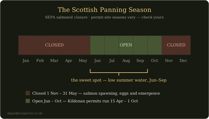
The Scottish Environment Protection Agency (SEPA) administers the Controlled Activities Regulations, which set the framework for what is and is not allowed in a Scottish watercourse. SEPA's good-practice criteria for recreational panning operate as a de facto licence-free regime: if you stay inside them, your activity is exempt from individual authorisation; if you fall outside them, you can be prosecuted as an offence under CAR. The criteria, in plain English, are: hand panning only, no powered machinery, no bank digging, refill any hollows the same day, no panning within 50 metres of water where freshwater pearl mussels may be present, and no panning between 1 November and 31 May, as the Strathfillan Community Development Trust publishes SEPA's best practice for Tyndrum.
That Tyndrum window is broader than the strict period when salmon redds are actively in the gravels. It is a precautionary window that brackets the spawning, the over-wintering eggs and the emergence of juveniles. The permit schemes publish their own windows rather than one shared rule: the Strathfillan Community Development Trust closes Tyndrum from 1 November to 31 May, the Suisgill Estate closes Kildonan from 1 October to 15 April, and the Wanlockhead licence page publishes no season. NatureScot's position statement reinforces SEPA's criteria for designated SSSIs and SACs, and confirms that compliant recreational panning does not require additional NatureScot consent within those designations.
The British Goldpanners Association code
Beyond statute, the British Goldpanners Association maintains a voluntary code of practice that goes slightly further than legal minimum — no powered equipment of any kind, one hand-pump per panner only, no bank disturbance under any circumstances, fill all holes, and leave each site cleaner than you found it. Most permit schemes incorporate the BGA code by reference. Working to it is the simplest way to make sure your behaviour stays inside both SEPA and the host estate's expectations.
Putting it all together
Three boxes to tick before any session, anywhere in Scotland: (1) landowner permission, ideally through a recognised permit scheme; (2) SEPA good-practice compliance, including the published closed season for the site you are on; (3) no SSSI or SAC sensitivity that would push you over the NatureScot consent threshold. For the typical beginner the permit sites tick all three boxes automatically. Off-piste sessions in Glen Shira, the Ochils or anywhere else in Scotland require you to handle each box yourself. The honest message of this section, which most competitor pages refuse to say plainly, is that the Crown's position on recreational gold removal is more restrictive than the public conversation suggests — and that the three permit-site framework is what makes the hobby work in practice. Full detail in our laws guide.
Best Season, Water Conditions and Equipment
Two seasons interact at every Scottish gold-panning site, and the productive trip is the one that lines both up. There is a legal window defined by the permit schemes and the SEPA spawning closure, and there is a hydrological window defined by what the river is actually doing. They overlap, but they are not the same thing.
The legal window
Each permit site publishes its own window rather than one shared rule: Tyndrum closes 1 November to 31 May (Strathfillan Community Development Trust); Kildonan closes 1 October to 15 April (Suisgill Estate); the Wanlockhead licence page publishes no season. At Tyndrum and Kildonan, legitimate panning is a late-spring-to-mid-autumn activity. Plan trips inside the published window for the site you are visiting, and confirm it with the issuer before you travel.
The hydrological window
Within the legal window, the most productive single span is mid-summer — typically mid-June through mid-September — when Highland and Uplands burns are at low summer water. Low water exposes gravel bars and bedrock that you cannot reach in spring, makes the slack-water traps obvious, and lets you wade comfortably with a pan and a trowel. A wet July does not ruin a trip; it just shifts the productive features and slows the work. A dry August is the gold standard if you are picking your weekend.
There is a second piece of timing that matters: the post-flood window. Gold only moves in flood-stage flows, and a major winter or spring storm re-sorts the river and lays down new pay-streaks. The richest sampling window of any year is the falling limb after the biggest spate of the previous winter — typically two to six weeks after the storm, once the water has cleared and dropped back to working level. That is why the third or fourth weekend of the post-closure period in a wet winter year can outperform the rest of the season. Full technique is in our river-reading guide.
Equipment rules by site
The three permit sites all operate inside SEPA's general framework but each has site-specific equipment conditions that you should read at the point of purchase. The standard kit accepted at all three is a pan (10–12 inches, plastic with built-in riffles), a classifier sieve (1/4 inch is the workhorse), a trowel, a small spade, a crevice tool, a snuffer bottle and vials. Beyond that, the rules diverge.
Suisgill at Kildonan permits a hand-operated gravel pump with a barrel of up to 2.5 inches but prohibits sluices outright. Wanlockhead's licence allows portable sluice use within the SEPA hand-equipment framework — confirm at the Museum desk before you buy a sluice for the trip. The Tyndrum Community Woodland permit follows the SEPA template but, as a community-managed site, the Trust may add specific conditions; check the current permit page before travelling. Powered equipment of any kind is prohibited at all three. Bank digging is prohibited at all three and is illegal everywhere else in the UK as well.
The honest kit list
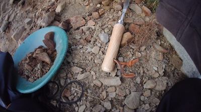
For your first three or four trips at the permit sites you do not need much. A decent 10-inch plastic pan, a 1/4 inch classifier, a trowel, a stiff brush, a snuffer bottle and a couple of vials will outperform any amount of gear if you are panning competently and reading the river properly. Add a Russian-style oval finishing pan, a magnet for separating magnetite from concentrate at home, and a pair of neoprene waders once you are working three-hour stretches in cold water. The full breakdown, including what to buy first and what to skip, is in our UK equipment guide.
If you only do two things between reading this guide and your first trip: read the river-reading guide for technique, and read the permit conditions for your chosen site for the equipment rules. The rest follows from those two.
The 1868–69 Sutherland Gold Rush and Scotland's Famous Nuggets
Scottish gold has the same cultural fingerprint in Britain that the Californian rush has in America, only on a smaller scale and a longer timeline. The headline event — the 1868–69 Sutherland Gold Rush — was over inside fifteen months, never produced more than a few hundred ounces of recovered gold, and lasted just long enough to put Kildonan permanently on the prospecting map. It remains the formative cultural moment for the British hobby.
Robert Gilchrist and the Strath of Kildonan
The 1869 rush began with one man. Robert Nelson Gilchrist was born in Kildonan and spent seventeen years on the Australian goldfields in the middle of the 19th century. He returned to Sutherland with a working knowledge of placer prospecting and obtained permission from the Duke of Sutherland to systematically prospect the Helmsdale tributaries. His work through 1868 produced enough gold to confirm the field, and an end-of-year newspaper announcement of his findings ignited the rush. By January 1869 prospectors were arriving in numbers; by spring of that year an estimated 600 were working the burns at peak. Two temporary settlements — Baile an Òir ("Town of Gold") and Carn na Buth — sprang up as collections of tents and timber huts; Helmsdale's hotels were overwhelmed.
The rush did not last. The Duke of Sutherland calculated that he was losing more in displaced sheep grazing and salmon-fishing income than he was gaining in licence fees from the prospectors, and announced closure of all prospecting on the estate with effect from 1 January 1870. Total recorded production from the entire rush was modest — estimates range from a few hundred to a few thousand ounces — and the lasting legacy was cultural rather than economic. The archaeological remains of Baile an Òir have been excavated; clay pipes, pottery fragments and metalwork from the village are now on display at the Timespan Museum in Helmsdale. A fuller treatment of this story, alongside the smaller Welsh and Cornish rushes, will follow in a forthcoming UK Gold Rushes article.
The Reunion Nugget — 121.3 g, 2019
The largest gold nugget reported from a British river is the Reunion Nugget, found in a Scottish river in 2019 by an anonymous prospector. It weighs 121.3 grams, is high-purity native gold equivalent to roughly 22 carat after assay, and was recovered using a technique called sniping — snorkelling in shallow water with hand tools to inspect bedrock pockets and gravel crevices in the active channel. The "Reunion" name reflects the fact that the piece was originally recovered as more than one fragment that matched up cleanly into a single nugget. The exact location was withheld by the finder, although the find is widely attributed to a Highland river system. Estimated valuations at the time of recovery clustered around £80,000, with collector premium pushing toward £100,000.
The Douglas Nugget — 85.7 g, 2017
Before it, the best-known British river nugget was the Douglas Nugget, 85.7 grams, recovered from a Perthshire river in 2017. Until the Reunion find it was the largest modern nugget reported from a British river. The Douglas Nugget is on permanent public display at the Hunterian Museum at the University of Glasgow. The story of these two finds together — two years apart, two anonymous prospectors, one technique — is part of the reason Scottish gold panning maintains the cultural pull that it does. It also frames the realistic expectation for the rest of us: nuggets of this calibre are multi-decade events, not weekend goals.
The Scottish gold premium
Verifiably-sourced Scottish gold sells for a substantial premium over bullion spot when worked into jewellery. Under Scotgold, Cononish gold was sold through a chain-of-custody system that let Edinburgh-based jewellers, including Sheila Fleet and Hamilton & Inches, offer hallmarked Scottish-gold collections at significant mark-ups. Historic Scotgold auction data showed premia of several hundred per cent over the prevailing bullion price for verified Cononish gold — a brand premium, not a market price quote, and one that applied inside the chain-of-custody framework.
Recreational placer specimens are a different proposition. They do not automatically attract the Cononish premium, because they sit outside any chain-of-custody scheme, but Scottish jewellers will sometimes buy individual flakes or small pickers for setting into custom pieces. Permit conditions at the three established sites can restrict commercial sale of finds from those sites — read your permit before selling. The full position on selling UK gold is set out in our laws guide. For most hobbyists the right answer is to keep the gold in a vial on a shelf, where its value as a souvenir of a Scottish weekend exceeds its melt value many times over.
The romance of the 1869 rush, the modern Reunion and Douglas nuggets, and the Cononish premium do not change the average outcome on a Saturday in July. A vial of flakes is the normal result, the rare picker is the upgrade, and a nugget is a story you'll tell forever. Set your expectations by the average.
A free 16-page summary of the best beginner sites, with GPS coordinates, equipment checklist and the legal cheat-sheet, is available as our UK Gold Prospector Beginner's Pack — the companion to this article.
Frequently Asked Questions
Do I need a permit to pan for gold in Scotland?
Yes — every legitimate session in Scotland runs under a permission of some kind. The Royal Mines Act 1424 vests gold and silver in the Crown, and Crown Estate Scotland, which manages those rights, does not issue recreational gold-panning licences. The three working schemes at Kildonan (Suisgill Estate), Wanlockhead (Buccleuch Estate via the Museum of Lead Mining) and Tyndrum Community Woodland (Strathfillan Community Development Trust) are local landowner and community arrangements, not delegated Crown grants. Everywhere else you need direct landowner permission plus compliance with SEPA's good-practice criteria. The full legal picture is in our UK gold panning laws guide.
What's the best time of year to pan for gold in Scotland?
There is no single legal window: each permit scheme publishes its own. The Strathfillan Community Development Trust's Tyndrum season runs 1 June to 31 October, the Suisgill Estate closes Kildonan from 1 October to 15 April, and the Wanlockhead licence page publishes no season. Hydrologically the best conditions are mid-summer low water — June through September — after a wet spring or once a storm cycle has re-sorted the gravels. A settled week of dry weather two to six weeks after a spate is the most productive single window.
How much gold will I realistically find?
Honestly, very little by weight. The vast majority of Scottish pans yield flour gold — sub-millimetre specks you only see when you tilt the pan to the light — and the occasional small flake one to two millimetres across. A fair day at Kildonan, Wanlockhead or Tyndrum is a dozen flakes and some black sand worth bottling. Pickers the size of a rice grain come up several times a season for regulars. Nuggets are exceptional: the Reunion Nugget at 121.3 g (2019) and the Douglas Nugget at 85.7 g (2017) made national news for a reason. Anyone selling you a guaranteed-nugget weekend is selling fiction.
Can I sell the gold I find in Scotland?
You can, with caveats. Verifiably-sourced Scottish gold has historically commanded a substantial premium over bullion spot when worked into jewellery — collections from Sheila Fleet, Hamilton & Inches and others have used chain-of-custody Cononish gold at significant mark-ups. Small recreational specimens won't automatically attract the same premium, but Scottish jewellers will sometimes buy single flakes or pickers for setting. Some permit schemes restrict commercial sale of finds taken from their sites, so read the conditions before you sell. The Crown technically owns unworked gold, which makes private sale a grey area; our laws guide covers the position in full.
Is metal detecting allowed at gold-panning sites in Scotland?
It's the wrong tool for the job. Scottish gold is overwhelmingly fine flake and flour — well below the detection threshold for typical hobbyist machines — so a metal detector won't find what panning will. Detectors come into their own on dry bench gravels and old terraces chasing the rare pickers and nuggets, which is a different specialism entirely. At permit sites the default position is to ask the permit holder before bringing a detector; some allow it, some don't. The full kit picture, including when a detector earns its keep, is in our equipment guide.
Where is the cheapest place to pan for gold in Scotland?
Tyndrum Community Woodland, on the issuers' published prices. The Strathfillan Community Development Trust sells day permits at £5 (£25 a week, £50 for the season) for its 1 June to 31 October 2026 season. Wanlockhead is next at £10 a day for an individual (Buccleuch Estate licences sold by the Museum of Lead Mining, which is closed to visitors until spring 2027), then the Kildonan Burn at £15 a day for an adult (Suisgill Estate). Prices as published by the issuers in October 2026; every permit and how to buy it is in our UK permit price guide.
What's the largest gold nugget ever found in Scotland?
The Reunion Nugget, 121.3 g, recovered from a Scottish river in 2019 by an anonymous prospector using sniping — snorkelling with hand tools to inspect bedrock pockets. The exact location was withheld at recovery. The Douglas Nugget at 85.7 g (2017) came two years earlier and is now on display at the Hunterian Museum at the University of Glasgow. The 1868–69 Sutherland Gold Rush at Kildonan produced its share of nuggets but few were systematically weighed and recorded, and the largest documented from that period are smaller than both modern finds. Set your expectations by the average, not the headline.
Is gold panning legal in Scottish rivers without permission?
No. Three legal layers sit over recreational gold panning in Scotland, and removing gold without permission breaches all three. The Royal Mines Act 1424 vests gold and silver in the Crown except where the rights were granted away by deed (including Sutherland and parts of Argyll), and Crown Estate Scotland does not license recreational removal. The Land Reform (Scotland) Act 2003 gives statutory access to land, but the Act explicitly excludes mineral extraction. SEPA's Controlled Activities Regulations require good-practice compliance, and each permit scheme publishes its own closed season. The only legal routes are the established permit schemes — Kildonan, Wanlockhead, Tyndrum and Leadhills Estate — or direct landowner permission elsewhere, combined with SEPA compliance. The laws guide covers each in full.
Where should a complete beginner start?
Take the Wanlockhead day course at the Museum of Lead Mining. It's the only place in the UK where a complete beginner can turn up alone, with no kit and no knowledge, and be panning real Scottish flake gold in the Mennock Water before lunch. Pans, riffles, classifiers and tuition are included, and the museum also issues the licence so the paperwork is handled. Once you've found your first flake, our beginner's guide sets out the next steps and the interactive map shows the wider network of verified sites to grow into.
Important: All UK gold panning is subject to Mines Royal rules (royal prerogative in England and Wales, the Royal Mines Act 1424 in Scotland, subject to old grants such as Leadhills), and to country-specific access, environmental and protected-site law. Crown Estate Scotland does not issue recreational gold-panning licences; the permit schemes referenced in this guide are local landowner and community arrangements, not delegated Crown grants. Always check current permit terms, landowner permission, SSSI/SAC status, and any relevant SEPA conditions before working any river. Never dig the bank. Do not pan outside the published season for the site you are visiting. This article is general guidance, not legal advice — verify current law with NatureScot, SEPA, Crown Estate Scotland or the relevant authority for your area. Full detail in our UK gold panning laws guide.
200 verified UK gold locations, every Scottish permit site mapped with access notes and geology — plan your next Scottish trip before you leave the house.
Open the Interactive Map →Free Beginner's Pack — 16-page PDF: top 10 UK locations with GPS, equipment checklist, legal cheat sheet and app tutorial.
Get the Free Pack →