England has the quietest gold story of the three mainland UK nations. There has never been an English gold rush, there has never been an English royal mine, there has never been an English commercial operation comparable to Cononish. What England does have is a thin but real distribution of alluvial gold across four geographically separated regions — the Lake District, Devon, Cornwall and the North Pennines — plus minor occurrences elsewhere, and a legal framework that is materially harder to navigate than Scotland's permit-backed equivalent. This guide is the honest version of "where".
The article works region by region, sets out the geology behind each, gives an honest account of what is and is not realistic for a recreational prospector, and covers the legal framework. Every named river is on the UK Gold Prospector interactive map with current access notes. The companion regional guide on where to find gold in Wales and the cornerstone Scotland piece sit either side of this one.
In this guide
- Why England is the UK's quietest gold region
- The geology behind English gold
- The Lake District — Caldbeck, Coniston and Cumbrian burns
- Cornwall and the tin-stream gold
- Devon — Dartmoor and the Tamar country
- The North Pennines — Tyne, Wear and the AONB
- Yorkshire and the forgotten streams
- English gold-panning law
- Best season and realistic expectations
- Frequently asked questions
See every English gold site on the live map
All 211+ BGS-verified UK locations with GPS coords, access notes and geology — Lake District, Cornwall, Devon and the North Pennines, mapped in seconds.
Unlock the England gold map — £7.99, one-off
Every verified English gold site on the live GPS map (Northern Ireland included): exact coordinates and access notes. Pay once, claim it with your email — no subscription.
Why England Is the UK's Quietest Gold Region
Three things explain why English gold panning sits in the shadow of the Scottish and Welsh hobby. The first is geology. The primary gold-bearing belts of the British Isles — the Dalradian Highlands and the Southern Uplands of Scotland, the Dolgellau belt of north-west Wales — do not extend in any major way into England. England has the southern fringe of the Caledonian system in the Lake District and the North Pennines, and the separate Cornubian granite-aureole system in the south-west, but neither of these matches the gold concentrations of the Scottish or Welsh primary deposits.
The second is history. The 1868–69 Sutherland rush put Scotland on the prospecting map permanently; the Royal Welsh gold tradition from 1923 onwards gave Wales a century-long cultural premium; the Roman mine at Dolaucothi in Carmarthenshire gave Wales the only confirmed Roman gold operation in Britain. England's gold history runs through base-metal mining at a smaller scale — the Lake District lead and copper country, the Cornish tin-streaming tradition — and never produced the headline event that would have established a recreational culture.
The third is law. Scotland has the three established permit schemes at Kildonan, Wanlockhead and Tyndrum where the landowner has formalised the access arrangement. England does not. Every English session needs landowner permission and Environment Agency compliance organised separately, by the prospector, for the specific stretch concerned. The administrative friction is high enough that the recreational hobby in England remains a much smaller, much more dispersed activity than its Scottish equivalent. The reality is that an English-based prospector who wants to recover gold reliably will still find the most productive single weekend is a trip north to the Wanlockhead permit. For the historical chronology of every major UK strike, see our UK Gold Rushes hub.
The Geology Behind English Gold
English gold comes from two geologically distinct provinces, separated by hundreds of millions of years of history and by most of the length of the country. Understanding which province you are working changes how you read the river and what you expect to find.
The Caledonian fringe — Lake District and Pennines
The Lake District Volcanic Group and the surrounding Skiddaw Slates form the southern tail of the Caledonian system that runs through Scotland. The same broad story of tectonic collision, fluid flow and quartz-vein mineralisation that produced the Scottish gold belts also produced the Lake District mineral province — but at a smaller scale and with a different mineralogical balance. Copper, lead and barytes dominated the historic mining economy of the Lake District; gold appeared as a low-level by-product in several of the base-metal mining areas, particularly around Caldbeck on the northern fringe of the fells and around Coniston on the southern.
The North Pennines lead-mining country, which has been an Area of Outstanding Natural Beauty since 1988, sits on a different but related fault-bounded mineral block — the North Pennine Orefield. Gold here is similarly a trace by-product of the dominant lead and zinc economy, distributed across the Tyne, Wear and South Tyne catchments at the level of occasional flakes rather than productive concentrations. Modern recreational access operates under AONB conditions plus the standard landowner-permission framework.

The Cornubian batholith — Cornwall and Devon
The granite of Cornwall and Devon — Bodmin Moor, Hensbarrow, Dartmoor and the smaller exposures off the main mass — is the surface expression of a huge late-Variscan intrusion known as the Cornubian batholith, emplaced around 280 million years ago. The hot fluids that circulated through the granite and its surrounding country rock during and after emplacement carried tin, copper, arsenic and minor base metals, plus trace gold. The famous Cornish tin-streamers of the medieval and early modern period worked the alluvial accumulations of cassiterite in the valley gravels, and recorded occasional gold recovery alongside the tin from at least the medieval period onwards.
Devon's gold comes from the eastern side of the same Cornubian system, particularly from the tributaries of the Bovey, Teign and Dart that drain the Dartmoor granite and its aureole. Devon was never as significant in the historic tin economy as Cornwall, but the underlying mineralogy is the same and the river gravels carry the same kind of trace flake gold.
Why all English panning gold is alluvial
The pattern is the same across both English provinces. The primary gold sits in vein and disseminated form in rocks that are mostly buried or otherwise inaccessible to a recreational prospector. The Pleistocene glaciation — which reached its southern limit roughly at the Bristol Channel — scoured the surface, exposed the source rocks, liberated their gold, and concentrated the eroded fragments into glacial outwash and post-glacial stream deposits. Cornish gold is the partial exception, because the Cornubian peninsula was largely south of the main ice cover; here the alluvial concentration runs through ordinary fluvial processes over longer geological time. In either case, what a 2026 prospector can recover with a pan is alluvial flake gold from re-sorted gravels, never primary vein material. Full technique is in our river-reading guide.
The Lake District — Caldbeck, Coniston and Cumbrian Burns
The Lake District is England's most consistently documented gold-bearing region after Cornwall, with a recorded history of base-metal mining that produced gold as a by-product going back to at least the sixteenth century. The two principal areas are Caldbeck on the northern fringe and Coniston on the south, with several smaller occurrences distributed across the fells in between.
The Caldbeck Fells
The Caldbeck Fells, around the village of Caldbeck on the northern edge of the Lake District National Park, host a series of mineralised veins worked from at least the sixteenth century for copper, lead and barytes. Documentary references to gold being assayed from Caldbeck ore go back to the early modern period, and modern geological surveys have confirmed the trace gold content of several of the local mineralised systems. The streams draining the Caldbeck mineral field — small upland becks running south to the Caldew and north to the Solway — carry low-concentration alluvial gold derived from the weathered base-metal veins.
Recreational access in 2026 operates under Lake District National Park byelaws plus the standard landowner-permission framework. Most of the productive country is private upland with a complex pattern of common rights and grazing tenure; identifying the correct landowner and securing written permission is the practical bottleneck for any session. Once in, the technique is the same as on any small upland burn — read the bedrock cracks, the boulder shadows, the gravel-bar tails.
The mineral field at Caldbeck occupies ground where the Ordovician-age Skiddaw Slates are traversed by a series of hydrothermal veins generated in part by the heat and fluid chemistry of the Carrock Fell Complex — an igneous intrusion of gabbro and granophyre that geologically separates the Caldbeck country from the central Lake District's volcanic sequence to the south. Gold occurs as a trace constituent within the same copper, lead and barytes vein systems that the historic mines exploited, and its presence is confirmed in mineral survey records and historical assay data from the early modern and Victorian periods, though the gold was never the primary economic target and was rarely quantified in terms useful to a recreational prospector. The stream catchments most associated with trace gold occurrence include those draining the Roughton Gill and Carrock Mine areas of the northern fell face, running down toward the Caldew; but comparative productivity across specific sites should be treated cautiously, since the published survey evidence draws on work that considerably pre-dates modern geochemical methods and was not compiled with alluvial panning in mind.
Coniston and the southern fells
The Coniston area on the south of the National Park has a longer continuous mining history than Caldbeck, with copper mining going back at least to the medieval period and continuing intermittently into the late nineteenth century. Trace gold has been recorded from Coniston ore deposits and from the gravels of the local becks, particularly Church Beck and the smaller tributaries running into Coniston Water from the surrounding fells. Coniston Copper Mines, now a heritage site under partial National Trust protection, is the most visible reminder of the historic operation.
The pattern of legal access is identical to Caldbeck — National Park byelaws, landowner permission, Environment Agency compliance. The Lake District concentration of National Trust land and conservation designations makes the administrative work harder than in less protected country, but the underlying right to pan with permission is preserved.
The Coniston Copper Mines represent one of the longest documented mining operations in England, with formal working records going back to the Elizabethan period and intermittent production continuing into the early twentieth century. The mines exploited copper-bearing lodes within the Borrowdale Volcanic Group — the thick sequence of ancient volcanic rock that underlies much of the central Lake District — and the trace gold content of those lodes was noted in Victorian-era mine reports and later geological surveys, though again as an incidental observation rather than a productive target. Church Beck, which drains the Copper Mines valley through the heart of the historic workings and runs down through Coniston village, is the most frequently cited of the local gold-bearing streams in the recreational gold literature; smaller tributaries draining the surrounding high fell country carry the same geological association, though their accessible stretches are shorter, steeper and considerably less well-documented. The Copper Mines site is now managed partly by the National Trust as a heritage destination, which carries its own access and consent implications for any prospector working in the immediate vicinity of the surviving mine structures.
Newlands Valley and the Goldscope tradition
One Lake District site worth mentioning by name for its historical significance is the Goldscope Mine in the Newlands Valley near Keswick. Despite the suggestive name, Goldscope was principally worked for copper and lead under royal licence in the late sixteenth century and never produced significant gold; the name itself appears to derive from a corruption of an older German term used by the imported Bohemian and Saxon miners who brought their mining vocabulary with them to the Lake District. The mine is now disused and the surrounding country sits inside the National Park with high conservation status, but the historical record is part of the broader picture of why the Lake District retains the gold-bearing reputation it does. Trace gold has been recorded from the Newlands Valley gravels and the smaller becks draining the Newlands Pass area carry the same broad alluvial signature as the Caldbeck and Coniston catchments.
What the designations mean for a pan-only visitor
The practical picture for a visitor arriving at the Lake District with a pan and a day to spare is worth setting out clearly, because the combination of designations operating across this country is more constraining in practice than it may appear on paper. Every part of the gold-relevant Lake District — Caldbeck, Coniston, Newlands and the fells between — sits within the Lake District National Park, which is also a UNESCO World Heritage Site. Significant stretches of the productive stream country are additionally notified as Sites of Special Scientific Interest administered by Natural England, and large areas are either National Trust access land or private common grazing with layered tenure arrangements. A National Park does not prohibit gold panning in principle, but its byelaws do prohibit the removal of natural materials from protected ground, which captures alluvial gold under any reasonable interpretation. An SSSI notification adds a separate written-consent requirement from Natural England for any activity capable of disturbing the designated habitat, including the in-river disturbance that panning necessarily involves. National Trust access land permits walking and many outdoor activities, but not ground-disturbing activity or the removal of natural materials without specific prior permission from the Trust.
In combination, these layers mean that a prospector without prior preparation is likely to be in breach of at least one of them at almost any productive Lake District site. The route through the constraints does exist — identify the landowner or common-rights holder for the specific bank-side parcel, confirm whether the stretch carries an SSSI notification and seek Natural England consent if it does, check the National Park Authority's byelaw guidance for the area, and confirm that the Environment Agency's good-practice framework for the catchment does not impose additional spawning closures for your planned dates. That preparation takes longer than booking a Scottish permit online, but the right to pan on a specific Lake District stretch with the correct permissions in place is not extinguished by any of these designations — it is simply conditional on having done the groundwork first.
Reading the Cumbrian becks
The Lake District becks are short, steep, often boulder-strewn and at low summer water they read clearly to a prospector with experience on Highland burns. The trap families are the same — bedrock cracks where the slate or volcanic rock is exposed, pressure shadows behind the larger boulders, gravel-bar tails on the gentler stretches near the valley bottoms. The technique is essentially identical to Wanlockhead or Kildonan with one practical caveat: Cumbrian flake gold is finer on average than its Scottish equivalents, which puts a premium on careful classification and patient final-stage panning. A 1/4 inch classifier is the workhorse; a finer 1/8 inch sieve is worth carrying for the final concentrate work. Full technique is in our river-reading guide.
Cornwall and the Tin-Stream Gold
Cornwall is the region with the longest continuous tradition of gold recovery in England, paradoxically because Cornwall was never primarily a gold-mining country. The medieval and early modern tin-streamers of the Carnon Valley, the Helford catchment and the Restronguet Creek area worked the alluvial cassiterite deposits and recovered small quantities of placer gold alongside the tin as a by-product. Documentary references to Cornish gold finds run from the late medieval period through to the present day. For the full picture, see our dedicated guide: Is there gold in Cornwall?
The Carnon Valley
The Carnon Valley, running through the parishes of Perranarworthal, Devoran and Bissoe in west Cornwall, is the most famous of the historic Cornish tin-streaming districts. The valley gravels were worked continuously from the medieval period through to the early twentieth century, producing the bulk of Cornwall's recorded alluvial tin output and a documented but minor stream of recovered gold. The mineral assemblage of the Carnon Valley placer is unusually rich for a small alluvial field — cassiterite, gold, the lead-arsenic compound mimetite, and trace tungsten — and the gold itself sits in flat flakes of high silver content reflecting the granite-aureole source.
Modern recreational access to the Carnon Valley operates under the standard England framework — landowner permission, Environment Agency compliance — plus the additional considerations of the Cornish Mining World Heritage Site, which inscribes much of the valley and constrains how much of the historic mining landscape can be disturbed. The valley is not a permit-backed site in the Wanlockhead sense; it is a landscape with documented gold-bearing gravels and a legal framework that requires careful navigation.
Helford and Restronguet
The Helford catchment and the Restronguet Creek area on the Fal Estuary carry the same kind of granite-aureole alluvial gold in smaller and more dispersed concentrations. The recovery history is less prominent than the Carnon but the underlying geology is the same. Both areas sit inside the Cornish Mining World Heritage Site footprint and operate under the same constraints. The Cornish gold is fine, scarce and slow to reward concentrated effort — the realistic outcome for a hobbyist on a permitted Cornish stretch is small flakes and the satisfaction of having worked country that has been producing gold since the medieval period.
Why Cornish gold has the silver content it does
One geochemical detail worth noting because it shapes how Cornish gold looks in the pan: placer gold recovered from the Carnon Valley and adjacent catchments characteristically carries a slightly higher silver content than typical Scottish placer gold, sitting at roughly 15–20 per cent silver compared with the 5–15 per cent typical of Highland flake. The visual effect is that Cornish flake gold has a marginally paler, more electrum-like colour in the pan than Scottish flake. Most prospectors will not notice this on a casual inspection, but it is part of why anyone trying to match a recovered specimen to its likely source region can sometimes do so confidently. The silver-rich composition reflects the granite-aureole hydrothermal source — a different fluid chemistry from the Dalradian or Moine-hosted Scottish deposits.
St Just and the West Penwith country
One further Cornish district worth a mention is the St Just area in West Penwith, the granite peninsula at the western end of Cornwall. The streams draining the granite into the Atlantic carry trace alluvial gold in the same broad pattern as the Carnon and Helford catchments, with the additional consideration that much of the West Penwith mineral country is now part of the Cornish Mining World Heritage Site at a high inscription density. Recreational access here is constrained by a combination of National Trust land holdings, AONB designation, and the heritage-site framework, with the practical effect that any session requires careful preparation. The country is geologically rich and historically productive but legally demanding.
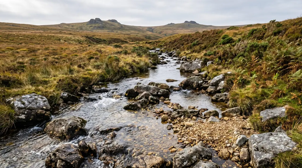
Devon — Dartmoor and the Tamar Country
Devon's gold comes from the eastern Cornubian system, particularly the catchments draining the Dartmoor granite and its surrounding aureole. Three river systems carry the bulk of the documented finds: the Bovey, the Teign and the tributaries of the Dart, with smaller contributions from the catchments draining north-west toward the Tamar and the Cornwall border.
The Bovey and the Teign
The Bovey, draining south from the north-east margin of Dartmoor, and the Teign, cutting through the granite on the eastern flank of the moor, both carry trace alluvial gold from the granite-aureole source. The recovery history here is quieter than the Cornish equivalent — Devon never had the great tin-streaming economy that put the Carnon Valley on the map — but the gold is real and modern recreational finds, while small, are reasonably consistent for prospectors who put in the time.
Dartmoor National Park byelaws restrict the activity in ways that the open Highland or Lowther country does not. The default position inside the National Park is to assume restriction until a site-specific check confirms otherwise, to obtain landowner permission for the relevant riverbank, and to comply with any Environment Agency conditions including the salmon-spawning closure where the catchment supports salmon or trout.

The Tamar country
The Tamar Valley AONB, straddling the Devon–Cornwall border, contains a series of smaller streams that drain the western fringe of the Dartmoor granite and the granite-aureole country to its south. Documented gold finds are sparse but real, and the area carries the same geological signature as the Cornish and eastern Dartmoor catchments. Access in the AONB operates under the area's specific conservation byelaws plus the standard landowner-permission framework.
The Dart and the southern Dartmoor catchments
The Dart and its tributaries draining the southern flank of Dartmoor — including the East and West Dart on the high moor, the Webburn and the Walkham — carry trace alluvial gold in the same granite-aureole pattern. The river runs through a mix of National Park, SSSI and Dartmoor Commons land, with multiple landowner and commoners' interests overlapping any single stretch. Practically this means the legal preparation for a Dart-system session is more involved than for an equivalent Lake District beck. The flake gold itself, when recovered, is fine and the gravels are commonly mixed with the heavy mineral fraction characteristic of the granite-aureole hydrothermal system, which makes the final-stage panning a longer process than on a cleaner Highland burn.
Realistic Devon expectations
Devon's documented recovery history runs at a lower rate than either Cornwall or the Lake District. A productive Devon session is a quiet recovery of a few small flakes and a snuffer bottle of black sand worth bottling for proper home processing. The country itself — the granite moor, the wooded valleys, the Dartmoor commons — is part of the appeal, but no prospector should plan a Devon trip expecting Wanlockhead-level returns. The pragmatic role of Devon in the English picture is as practice country: somewhere a local hobbyist can build technique on familiar rivers without the legal complexity that gathers around the more famous Cornish or Cumbrian sites.
The North Pennines — Tyne, Wear and the AONB
The North Pennines is England's largest single area of designated upland — an AONB designated in 1988 and a UNESCO Global Geopark — and its lead-mining heritage stretches back to at least the Roman period. Gold occurs across the North Pennine Orefield as a trace by-product of the dominant lead-zinc economy, distributed across the upper Tyne, the upper Wear and the South Tyne catchments at low concentration.
The documented recreational gold finds from the North Pennines are sparse and scattered. There is no equivalent of the Carnon Valley or the Lake District base-metal mining country in terms of continuous recovery history; the gold is real but the average pan produces flour and the occasional small flake rather than recoverable concentrations. The mining heritage itself — the Killhope and Nenthead lead-mining sites, the spoil tips and dressing floors of the surviving Victorian operations — is the more substantial attraction for most visitors.

Recreational access in 2026 operates under the AONB's byelaws, the standard landowner-permission framework, and the Environment Agency's good-practice criteria for in-river activity. The conservation status of the upper Tyne and Wear catchments is high enough that any session needs to be planned with explicit reference to the SSSI and SAC designations that overlap large parts of the area.
Killhope, Nenthead and the mining heritage
Two specific North Pennines locations are worth mentioning for the heritage rather than the panning. Killhope, in upper Weardale, preserves a late-Victorian lead-mining and crushing operation as an open-air museum with a working water wheel, dressing floors and the surrounding spoil tips. Nenthead, further west across the watershed, was the headquarters of the London Lead Company's North Pennines operation through the eighteenth and nineteenth centuries and remains one of the most complete surviving mining-village landscapes in England. Both sites give the historical context for why the surrounding burns carry the trace gold they do, and both repay a visit before any panning session in the wider area. The visitor centres are also useful sources for who owns which adjacent land — the practical first step before any session.
The reality of North Pennines panning
An honest summary of what a recreational prospector should expect from the North Pennines: a thin scatter of flour gold and the rare small flake from the productive features on the upper Tyne and Wear tributaries, with the average pan delivering little or nothing of consequence. The country is geologically real for gold — the lead-mining record proves it — but the practical concentration on a working-day basis is well below the Lake District or Cornish equivalents, and the legal preparation is more demanding because of the layered AONB, SSSI and Geopark designations. North Pennines panning is a long-term hobby for prospectors who live in the area and accept the modest returns; it is not a destination weekend.
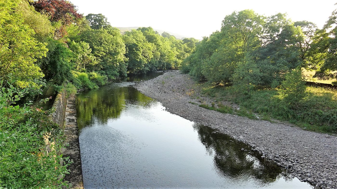
Yorkshire and the Forgotten Streams
The Yorkshire Dales and the Howgill Fells contain a thin scatter of documented gold occurrences across the upper Wensleydale, Swaledale and Lune catchments. These are not productive recreational gold rivers in the sense the Lake District or Cornish equivalents are — the recorded finds are isolated, the geological setting is patchy, and the recreational tradition is essentially non-existent. The area is included here for completeness rather than as a recommendation.
The geological context is the same broad Carboniferous limestone-and-shale country that hosts the major Yorkshire lead-mining tradition at Greenhow Hill, Grassington and Swaledale. Gold occurs in the same mineralisation systems as a trace constituent. A prospector working a Yorkshire Dales or Howgill stream in 2026 is doing exploratory work without an established framework — every session needs to be planned from first principles with landowner permission, Environment Agency compliance and Yorkshire Dales National Park byelaws all addressed individually.
The Greenhow Hill context
Greenhow Hill, in the Yorkshire Dales National Park between Pateley Bridge and Grassington, was one of the most productive of the Yorkshire lead-mining districts through the eighteenth and nineteenth centuries, with operations dating back to the Roman period. Trace gold has been recorded from Greenhow ore deposits, although the historic primary economic driver was always lead. The Greenhow context is useful because it confirms the underlying mineralisation pattern of the Yorkshire Dales: gold is present in trace concentrations across the broader lead-zinc-fluorite system, dispersed through enough of the country that some occasional small flakes will end up in the gravels of the local burns, but at a concentration that does not support a recreational gold tradition the way the Lake District or Cornish equivalents do.
The Howgill Fells
The Howgill Fells, sitting in the unusually quiet country between the Lake District and the Yorkshire Dales National Parks, drain west to the Lune and east to the Ure. The geology is older than the surrounding limestone country — Silurian and Ordovician sandstones and slates representing the western margin of the same Caledonian system that hosts the Lake District and Southern Uplands gold provinces. The Howgill burns carry the geological signature of gold-bearing country but the recorded recovery history is essentially nil. The fells remain genuinely under-explored for recreational panning, and any prospector working them in 2026 is doing the kind of speculative first-principles work that built the recreational gold tradition in better-known regions decades or centuries ago.
English Gold-Panning Law
The legal framework for recreational gold panning in England is materially different from the Scottish equivalent and worth understanding before any session. There are four overlapping layers.
Layer 1 — the Crown owns the gold
The Royal Mines Act 1693 vests all unworked gold and silver in England and Wales in the Crown. The rights are administered by the Crown Estate — a different body from Crown Estate Scotland, which administers the equivalent Scottish rights under the Royal Mines Act 1424. The credibility-defining point is the same on both sides of the border: the Crown Estate does not issue recreational gold-panning licences. There is no English equivalent of the three Scottish permit schemes, and no equivalent of any local landowner arrangement that has formalised a recreational fee structure at scale. The Crown's position on recreational removal of gold is more restrictive than the public conversation often suggests.
Layer 2 — landowner permission
England does not have a statutory right of responsible access equivalent to the Land Reform (Scotland) Act 2003. Access to most rural land in England operates under the Countryside and Rights of Way Act 2000, which gives a right of access to mapped "open access" land but excludes activities involving disturbance of the ground or removal of natural materials. For gold panning, the working assumption is that direct landowner permission for the specific riverbank is required for every session, written down where possible, with the scope of the permitted activity clearly described.
Layer 3 — the Environment Agency and protected sites
The Environment Agency administers the in-river activity framework in England, parallel to SEPA's role in Scotland and NRW's role in Wales. The Agency's good-practice criteria for recreational panning cover hand-tool-only working, refilling any disturbance the same day, the same kind of spawning closure that SEPA applies in Scotland, and any catchment-specific conditions for protected species. SSSI designations administered by Natural England, AONB conservation byelaws, and the byelaws of the relevant National Parks (Lake District, Dartmoor, North York Moors, Yorkshire Dales) all add further layers in the regions where they apply.
Layer 4 — the Treasure Act 1996
The Treasure Act 1996 governs the reporting and ownership of certain finds in England, Wales and Northern Ireland. Alluvial flake gold recovered from a stream by a hobbyist using a pan does not in itself meet the technical definition of "treasure" — the Act applies principally to coin hoards, prehistoric metalwork in association, and certain qualifying single finds — but any prospector who recovers a worked object of historical interest from river gravel needs to consider the Act's reporting requirements and work with the local Finds Liaison Officer through the Portable Antiquities Scheme. The default position for any non-natural find is to record it, report it and follow the PAS process. Full detail is in our UK gold panning laws guide.
Best Season and Realistic Expectations
The hydrological and ecological seasons for English gold panning follow the same broad pattern as the Scottish equivalent, with regional adjustment for the milder climate and the differing salmon-and-trout calendars of the English catchments.
The hydrological window
Low summer water is the productive condition across all four English regions, typically from mid-June through mid-September in an average year. The post-flood window after a major winter spate — two to six weeks after the storm, once the water has cleared and dropped to working level — is the single most productive sampling opportunity because the river has re-sorted its gravels and laid down fresh pay-streaks. Wetter English summers in Cornwall and the Lake District can compress the productive window but rarely close it entirely.
The ecological window
The Environment Agency's good-practice criteria broadly follow SEPA's 1 November to 31 May closure where Atlantic salmon and trout are present, with regional variation depending on the catchment. The Bovey, the Teign, the Tamar and the larger Cumbrian rivers all support salmonid populations and fall within the closure framework. Smaller catchments without salmon or trout may have less restrictive timing rules but still require Agency-compliant working practice.
Realistic expectations
An honest summary of what an English recreational prospector can expect on a permitted stretch: flour gold and the occasional small flake. The Carnon Valley is the most productive single English district by historical record; the Lake District base-metal country is the most consistent. None of the English regions delivers the same productive rate as Wanlockhead, Kildonan or Tyndrum. The realistic outcome for a half-day session in any of the four regions, working hand tools competently on a productive feature, is a snuffer bottle of black sand with visible colour in it and a couple of flakes worth bottling. The full kit context is in our UK equipment guide, and the beginner's route in is in the beginner's guide.
The pragmatic reading for any English-based prospector: build your technique on a local Cornish, Devon, Cumbrian or Pennine river under landowner permission, treat the recreational sessions as practice, and book one trip a year to Wanlockhead or Kildonan for the productive weekend. England is where you learn; Scotland is where you recover.
Frequently Asked Questions
Is there really gold in England?
Yes, in trace quantities across four broad regions: the Lake District, Devon and Dartmoor, Cornwall, and the North Pennines, plus minor occurrences in Yorkshire and the Howgill Fells. England is the quietest of the three mainland nations for gold — there has never been an English equivalent of the 1868 Sutherland rush or the Welsh Dolgellau belt — but the gold is real, it is alluvial, and a careful prospector working a productive feature on a permitted stretch of one of the named rivers can recover small flakes. Expectations should be set lower than for Scotland or Wales.
Where's the best place to pan for gold in England?
There is no single "best" English site comparable to the permit-backed Scottish trio at Kildonan, Wanlockhead and Tyndrum. The Carnon Valley tin-stream country in Cornwall has the longest continuous history of recreational gold recovery; the Caldbeck and Coniston streams in the Lake District have a documented base-metal mining history that produced gold as a by-product; the Dartmoor tributaries of the Bovey, Teign and Dart in Devon have produced consistent small finds. None of them is set up the way the Scottish permit sites are — every English session needs landowner permission and Environment Agency compliance organised separately.
Do I need a permit to pan for gold in England?
There is no permit-backed recreational scheme in England equivalent to the three Scottish sites. The legal route is direct landowner permission for the relevant stretch of riverbank, combined with compliance with Environment Agency conditions for in-river activity and any National Park, AONB or SSSI restrictions that apply to the site. The Crown Estate, which administers the Crown's ownership of unworked gold in England and Wales, does not issue recreational gold-panning licences. Full legal detail is in our UK gold panning laws guide.
Can I pan for gold in Cornwall?
Yes, with permission. The Carnon Valley, the Helford catchment and the Restronguet Creek area have a documented history of recreational gold recovery going back to the medieval tin-streaming period. Cornish placer gold sits in the granite-aureole streams of the Cornubian batholith and is concentrated in the same gravel bars that produced the historic cassiterite. Recreational access in 2026 operates under the standard England framework — landowner permission plus Environment Agency compliance — and is further constrained inside the Cornish Mining World Heritage Site, which adds heritage and conservation conditions. There is no permit-backed scheme equivalent to Wanlockhead.
Is gold panning allowed in National Parks?
It is permitted in principle but constrained in practice. National Park byelaws restrict ground disturbance and the removal of natural materials in ways that catch most forms of recreational panning. The Lake District, Dartmoor and the North York Moors National Parks all have specific byelaws that a prospector needs to check before working any river inside their boundary. The default position in any National Park is to assume restriction until a site-specific check confirms otherwise, to obtain landowner permission, and to operate under Environment Agency good-practice conditions including any spawning closure that applies to the relevant catchment.
How does English gold compare to Scottish or Welsh gold?
English alluvial gold is generally finer in grain size, less concentrated by area, and historically less productive than the Scottish or Welsh equivalents. The Lake District base-metal mining country produced gold as a recorded by-product but never as a primary target. The Cornish tin-stream gold was a real but small fraction of the total cassiterite economy. England has never produced a true gold rush, has no equivalent of the Welsh Dolgellau belt's royal contract, and has no equivalent of the Scottish Cononish commercial mine. The gold is real; the scale is smaller. The full UK comparison is in our UK Gold Rushes hub.
What's the largest gold nugget found in England?
There is no well-documented record-holder for England comparable to the Scottish Reunion Nugget (121.3 g, 2019) or the Douglas Nugget (85.7 g, 2016). The largest documented English finds have been small pickers and consolidated flakes rather than true nuggets, and the relative paucity of substantial finds is one of the reasons English gold panning has the quiet reputation it does. The honest framing for any English prospector is that flake recovery is the realistic ceiling for almost every recorded session.
Can I keep gold I find on the foreshore?
Foreshore is a separate legal category in England and Wales. Most of the foreshore between mean high water and mean low water is owned by the Crown Estate, and recreational activity is governed by separate Crown Estate foreshore permissions rather than the standard riverbank rules. Some local authorities and harbour authorities administer specific stretches under devolved arrangements. The default position for any foreshore gold recovery is to obtain the relevant Crown Estate or local authority permission and to comply with any Treasure Act 1996 obligations if a find could fall within its scope. Alluvial flake gold from a river is not in itself "treasure" under the Act.
Where should an English beginner start?
Be honest with yourself about the limits. For a first-time prospector based in England the most productive single weekend is still a trip north to one of the Scottish permit sites — Wanlockhead in the Southern Uplands is the cheapest and most accessible from northern England. For practising the technique locally, identify a Cornish, Devon or Cumbrian stretch where you can secure landowner permission, treat the activity as recreational rather than productive, and build a season's experience before moving to the more demanding off-permit sites. The full route in is in our beginner's guide.
Important: All UK gold panning is subject to the Royal Mines Act 1693 (England & Wales) and the Royal Mines Act 1424 (Scotland), and to country-specific access, environmental and protected-site law. The Crown Estate does not issue recreational gold-panning licences. There is no permit-backed recreational scheme in England equivalent to the three Scottish sites. Always check current landowner permission, SSSI/SAC status, National Park, AONB and Environment Agency conditions before working any river. Never dig the bank. This article is general guidance, not legal advice — verify current law with the Environment Agency, Natural England or the relevant authority for your area. Full detail in our UK gold panning laws guide.
211+ BGS-verified UK gold locations including every documented English site — access notes, geology and the wider regional picture.
Open the Interactive Map →Free Beginner's Pack — 16-page PDF: top 10 UK locations with GPS, equipment checklist, legal cheat sheet and app tutorial.
Get the Free Pack →